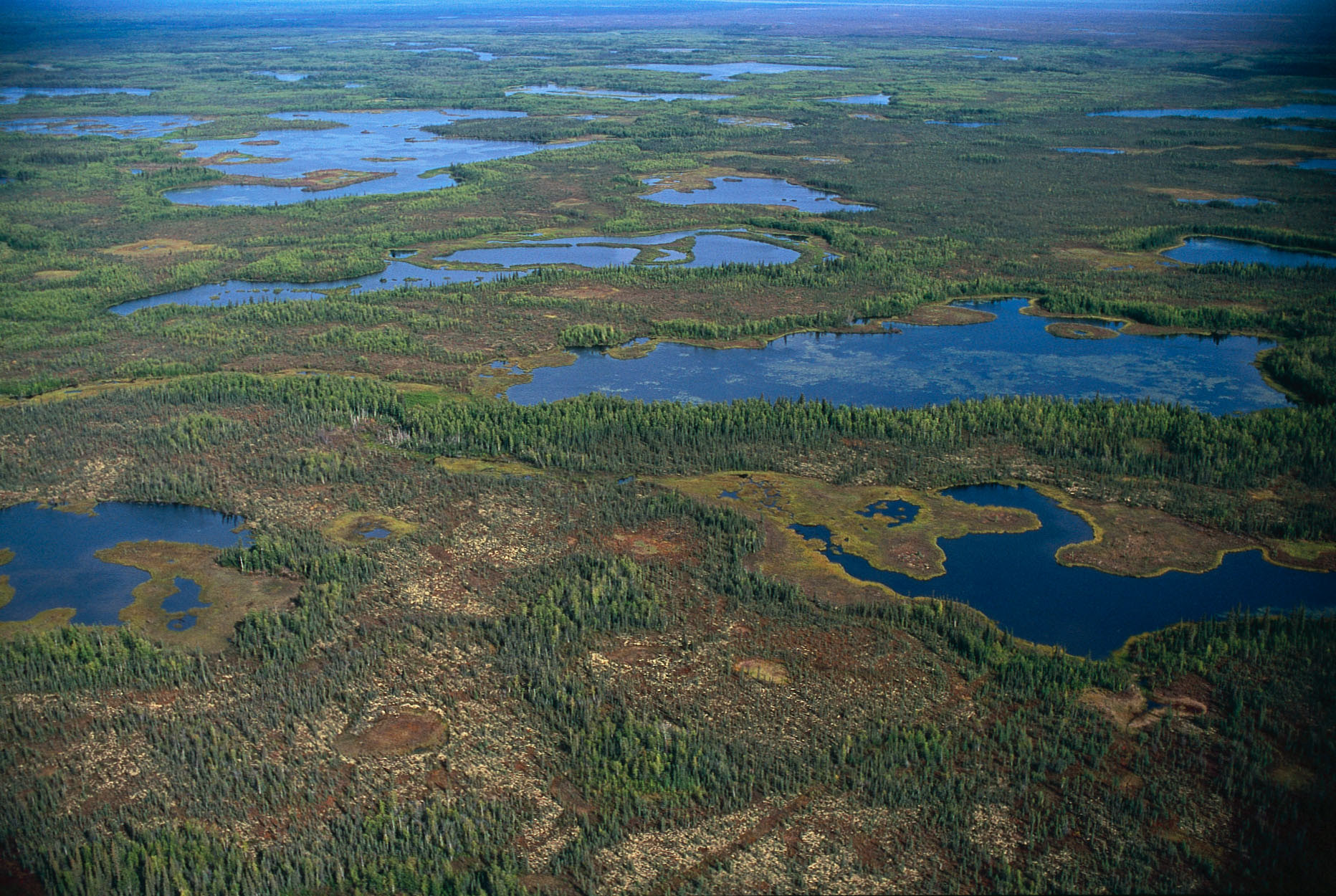
Ts’udé Nilįné Tuyeta – A New Protected Area is celebrated in the Sahtu Region, NWT
November 27, 2019 – The Canadian Parks and Wilderness Society’s NWT Chapter (CPAWS-NWT) extends its congratulations to the K’asho Got’ine Dene and Metis, the Government of the Northwest Territories (GNWT) and the many partners who celebrated the signing of an establishment agreement for the Ts’udé Nilįné Tuyeta Protected Area yesterday in the community of Rádeyı̨lı̨kóé (Fort Good Hope) located in the Sahtu Region of the NWT.
Ts’udé Nilįné Tuyeta (pronounced Tsoo-den-ee-len Too-yuh-ta), also known as the Ramparts River and wetlands encompasses 10,050 square kilometres of K’asho Got’ı̨nę traditional territory and is an area of abundant wildlife, fish, birds caribou, moose and furbearing animals.
CPAWS-NWT is thankful for the vision of K’asho Got’ı̨nę elders who identified Ts’udé Nilįné Tuyeta as an important area to protect. Ts’udé Nilįné Tuyeta will continue to provide for the K’asho Got’ı̨nę as it has for generations and is a positive outcome in the fight against the global climate change and biodiversity crisis’.
Ts’udé Nilįné Tuyeta is an example of how Indigenous Nations are leading efforts to conserve areas of their traditional territories for their own future and for the benefit of all Canadians,” stated Kris Brekke CPAWS-NWT Executive Director.
Ts’udé Nilįné Tuyeta Key Events:
• 1993 – The Ramparts is identified as a Sahtú heritage place/site in the Sahtú Dene and Métis Comprehensive Claim
• 2006 – Ts’udé Nilįné Tuyeta is sponsored as a candidate protected area under the NWT Protected Areas Strategy
• 2012 – The Final Working Group Recommendation Report is released
• 2013 – The K’asho Got’ine Lands Corporation requests establishment of Ts’udé Nilįné Tuyeta
• 2018 – Notice is provided to Sahtú Land Use Planning Board that the GNWT is in negotiations to pursue Ts’udé Nilįné Tuyeta under the NWT – Protected Areas Act
• 2019 – The GNWT and the K’asho Got’ı̨nę (including the local Yamoga Land Corporation), the Fort Good Hope Métis Nation Local #54 Land Corporation, and the Fort Good Hope Dene Band sign an establishment agreement for Ts’udé Nilįné Tuyeta on September 4th
A Few Ts’udé Nilįné Tuyeta Facts:
• The protected area is adjacent to the Gwich’in Settlement Area to the west and the Mackenzie River to the east and is about a third of the size of Vancouver Island (10,050 sq./km)
• Boreal forest and wetland habitats provide for several Species at Risk including grizzly bear, boreal and mountain woodland caribou, as well as short-eared owl, peregrine falcon and wolverine
• The area is a “key migratory bird terrestrial habitat site”; it supports over 1% of the national populations of a number of migratory bird populations
• The watershed is an important wetland that filters millions of litres of water per day
• The area has many cultural places of importance including archaeological sites, burial sites and traditional trails
• The NWT Protected Areas Act prohibits industrial scale resource extraction and other large-scale energy projects
• The GNWT and K’asho Got’ine will collaborate to implement the Ts’udé Nilįné Tuyeta establishment agreement. This includes forming a management board and preliminary work on developing a management plan
Information Sourced From:
https://www.enr.gov.nt.ca/en/services/conservation-network-planning/tsude-niline-tuyeta

![CPAWS NWT Logo [Transparent Background] CPAWS NWT](https://cpawsnwt.org/wp-content/uploads/2018/09/CPAWS-NWT-Logo-Transparent-Background.png)